- Kibana Guide: other versions:
- Introduction
- Set Up Kibana
- Getting Started
- Discover
- Visualize
- Dashboard
- Timelion
- Canvas
- Machine learning
- Maps
- Infrastructure
- Logs
- APM
- Uptime
- Graphing Connections in Your Data
- Dev Tools
- Monitoring
- Management
- Reporting from Kibana
- REST API
- Kibana Plugins
- Contributing to Kibana
- Limitations
- Release Highlights
- Breaking Changes
- Release Notes
- Kibana 6.7.2
- Kibana 6.7.1
- Kibana 6.7.0
- Kibana 6.6.2
- Kibana 6.6.1
- Kibana 6.6.0
- Kibana 6.5.4
- Kibana 6.5.3
- Kibana 6.5.2
- Kibana 6.5.1
- Kibana 6.5.0
- Kibana 6.4.3
- Kibana 6.4.2
- Kibana 6.4.1
- Kibana 6.4.0
- Kibana 6.3.2
- Kibana 6.3.1
- Kibana 6.3.0
- Kibana 6.2.4
- Kibana 6.2.3
- Kibana 6.2.2
- Kibana 6.2.1
- Kibana 6.2.0
- Kibana 6.1.4
- Kibana 6.1.3
- Kibana 6.1.2
- Kibana 6.1.1
- Kibana 6.1.0
- Kibana 6.0.1
- Kibana 6.0.0
- Kibana 6.0.0-rc2
- Kibana 6.0.0-rc1
- Kibana 6.0.0-beta2
- Kibana 6.0.0-beta1
- Kibana 6.0.0-alpha2
- Kibana 6.0.0-alpha1
IMPORTANT: No additional bug fixes or documentation updates
will be released for this version. For the latest information, see the
current release documentation.
Vector layer
editVector layer
editThe vector layer displays points, lines, and polygons.
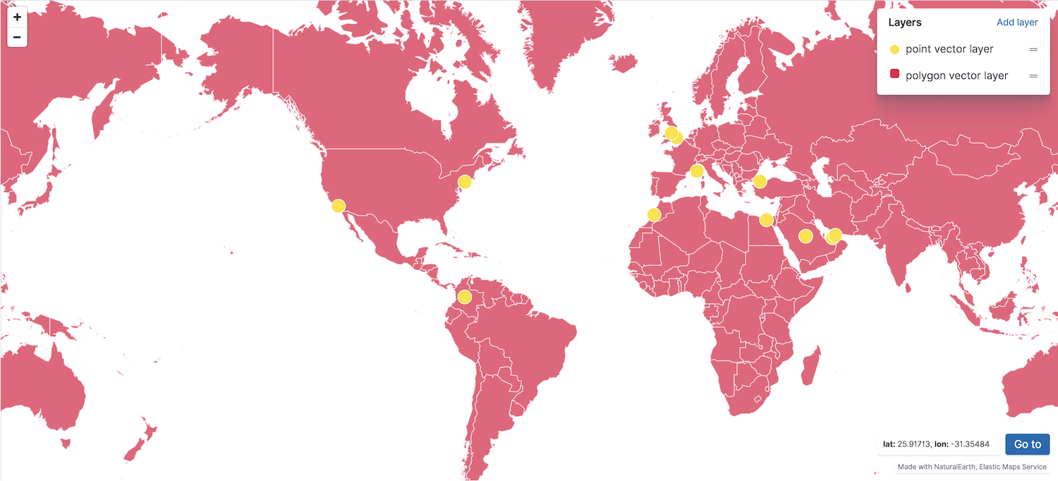
You can create a vector layer from the following sources:
- Custom vector shapes
- Vector shapes from static files configured in kibana.yml. See map.regionmap.* in Configuring Kibana for details.
- Documents
- Geospatial data from a Kibana index pattern. The index must contain at least one field mapped as geo_point or geo_shape.
- Grid aggregation
- Geospatial data grouped in grids with metrics for each gridded cell. Set Show as to grid rectangles or points. The index must contain at least one field mapped as geo_point.
- Vector shapes
- Vector shapes of administrative boundaries from Elastic Maps Service.
Was this helpful?
Thank you for your feedback.